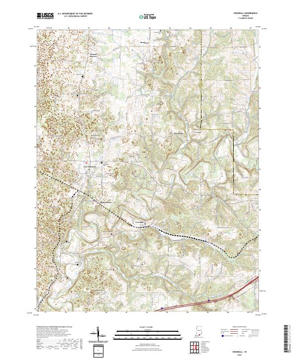
2022 Map of Crandall
USGS Topo · Published 2022About this map
Crandall and its neighboring hamlets sit within a landscape shaped by the Norfolk Southern rail line and the meandering path of Indian Creek. This region of Harrison and Floyd counties is characterized by a dense network of country roads connecting established settlements like New Salisbury and Byrneville. For the local historian or genealogist, the map reveals a remarkably well-preserved record of early family and community anchors, featuring nearly a dozen named burial sites including the German Methodist Cem, Flock Family Cem, and Kaylor Cem. The transition from the rural crossroads of Central Barren in the north to the rail-oriented siding at Mott Station illustrates the varied development of small Indiana townships. Prominent landmarks such as Hancock Chapel and Byrne Field further define the social and physical geography of this southern Indiana landscape.
Find a feature on this map
133 named features on this map. Tap any name to fly to it.
Don’t see what you’re looking for? This feature index may not catch every label — zoom into the map to look around manually.
Map Details
Editions of this 2022 Crandall Map
This is the sole edition of this map. No revisions or reprints were ever made.
Other maps of this area

1909 · Kosmosdale
USGS Topo · 1:48,000

1912 · Kosmosdale
USGS Topo · 1:62,500

1931 · Corydon
USGS Topo · 1:62,500

1939 · Georgetown
USGS Topo · 1:24,000

1941 · Borden
USGS Topo · 1:24,000

1944 · Corydon West
USGS Topo · 1:24,000

1946 · Depauw
USGS Topo · 1:24,000

1947 · Georgetown
USGS Topo · 1:24,000

1947 · Corydon West
USGS Topo · 1:24,000

1948 · Corydon East
USGS Topo · 1:24,000