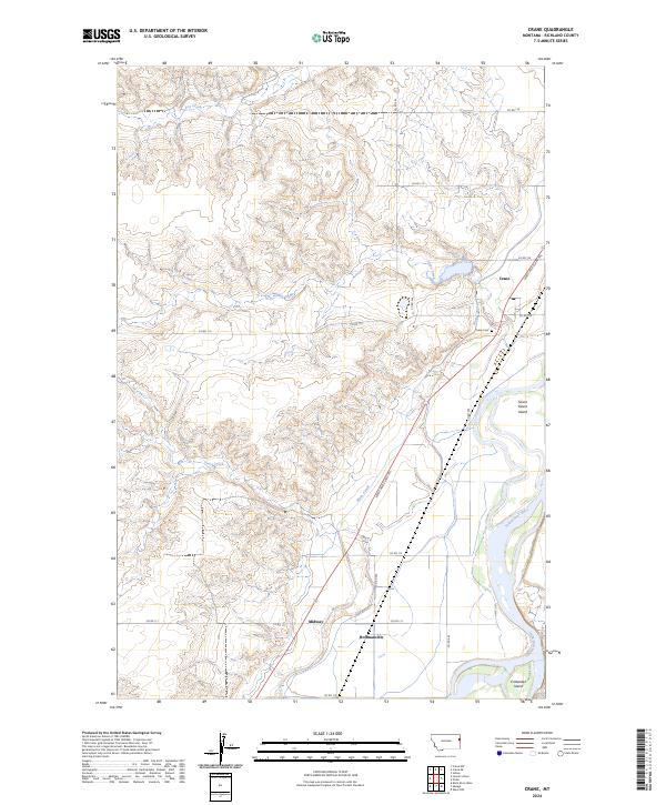
2024 Map of Crane
USGS Topo · Published 2024About this map
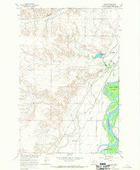
The Yellowstone River corridor in eastern Montana defines this landscape, where the braided river channel creates large landforms like Seven Sisters Island and Crittenden Island. Agricultural development is inextricably linked to the water, evidenced by the Main Canal and the historic Lewis and Clark Trl that follows the valley floor. Small clusters of settlement like Crane, Midway, and Hoffmanville dot the eastern bank, connected by a network of county roads including Co Rd 111 and Co Rd 115.
Find a feature on this map
27 named features on this map. Tap any name to fly to it.
Don’t see what you’re looking for? This feature index may not catch every label — zoom into the map to look around manually.
Map Details
Editions of this 2024 Crane Map
This is the sole edition of this map. No revisions or reprints were ever made.