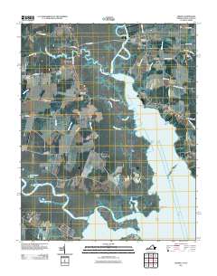
2011 Map of Creeds
USGS Topo · Published 2011About this map
The North Landing River dominates this coastal landscape, carving a wide path through the marshy lowlands near the Virginia-North Carolina border. In the early 21st century, small communities like Creeds and Blackwater remained anchored by legacy landmarks, including Oak Grove Cemetery, Blackwater Cemetery, and Bethel Cemetery. The geography is defined by its relationship to the water, with numerous points and islands such as Munden Point, Gibbs Point, and Faraby Island protruding into the river's expanse. To the south, the Northwest River feeds into Tull Bay near the settlement of Greentown. This era's infrastructure is marked by a network of rural roads such as Princess Anne Rd and Pungo Ferry Rd, which connect the scattered hamlets of Vine and Munden to the larger river system, reflecting a long-standing maritime and agricultural heritage.
Find a feature on this map
48 named features on this map. Tap any name to fly to it.
Don’t see what you’re looking for? This feature index may not catch every label — zoom into the map to look around manually.
Map Details
Editions of this 2011 Creeds Map
This is the sole edition of this map. No revisions or reprints were ever made.
Other maps of this area

1893 · Virginia Beach
USGS Topo · 1:125,000

1916 · Back Bay
USGS Topo · 1:62,500

1939 · Moyock
USGS Topo · 1:62,500

1940 · Barco
USGS Topo · 1:62,500

1943 · Back Bay
USGS Topo · 1:62,500

1946 · Moyock
USGS Topo · 1:62,500

1946 · Eastville
USGS Topo · 1:250,000

1946 · Currituck Sound
USGS Topo · 1:250,000

1948 · Elizabeth City
USGS Topo · 1:62,500

1953 · Norfolk
USGS Topo · 1:250,000