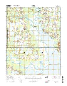
2016 Map of Creeds
USGS Topo · Published 2016About this map
The North Landing River and the Intracoastal Waterway define the aquatic character of this coastal borderland, where the southern reaches of Virginia meet North Carolina. Small residential hubs like Blackwater, Creeds, and Vine are situated on higher ground among a landscape of intricate marshlands and creek systems. The transition from terrestrial to maritime life is evident at Munden Point and the southern Tull Bay area, where the Northwest River flows toward the coast. Historical continuity is marked by local landmarks like Oak Grove Cem and Blackwater Cem, while family-named roads like Williams Farm Rd and Morris Neck Rd grid the remaining agricultural and wooded tracts. The presence of Buck Island Pond and Nellie Bell Ponds highlights the unique hydrography of this low-lying region.
Find a feature on this map
72 named features on this map. Tap any name to fly to it.
Don’t see what you’re looking for? This feature index may not catch every label — zoom into the map to look around manually.
Map Details
Editions of this 2016 Creeds Map
This is the sole edition of this map. No revisions or reprints were ever made.
Other maps of this area

1893 · Virginia Beach
USGS Topo · 1:125,000

1916 · Back Bay
USGS Topo · 1:62,500

1939 · Moyock
USGS Topo · 1:62,500

1940 · Barco
USGS Topo · 1:62,500

1943 · Back Bay
USGS Topo · 1:62,500

1946 · Moyock
USGS Topo · 1:62,500

1946 · Eastville
USGS Topo · 1:250,000

1946 · Currituck Sound
USGS Topo · 1:250,000

1948 · Elizabeth City
USGS Topo · 1:62,500

1953 · Norfolk
USGS Topo · 1:250,000