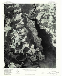
1977 Map of Creeds
USGS Topo · Published 1979About this map
North Landing River dominates this orthophotograph, providing a detailed look at the Virginia and North Carolina borderlands in the late 1970s. This hybrid map combines traditional cartographic labels with aerial photography, revealing the precise layout of agricultural fields and marshlands surrounding the settlements of Creeds and Munden. The intricate drainages of Blackwater Creek wind through the western portion of the quadrangle, illustrating the complex hydrology of the Atlantic coastal plain. The small community of Vine is situated amidst a grid of active farmland, showing the land-use patterns prior to modern coastal development. In the south, the transition from the river into Tull Bay captures the character of this tidewater region, where the interplay of water and land dictated the placement of small rural villages and their connecting roads.
Find a feature on this map
6 named features on this map. Tap any name to fly to it.
Don’t see what you’re looking for? This feature index may not catch every label — zoom into the map to look around manually.
Map Details
Editions of this 1977 Creeds Map
This is the sole edition of this map. No revisions or reprints were ever made.
Other maps of this area

1893 · Virginia Beach
USGS Topo · 1:125,000

1916 · Back Bay
USGS Topo · 1:62,500

1939 · Moyock
USGS Topo · 1:62,500

1940 · Barco
USGS Topo · 1:62,500

1943 · Back Bay
USGS Topo · 1:62,500

1946 · Moyock
USGS Topo · 1:62,500

1946 · Eastville
USGS Topo · 1:250,000

1946 · Currituck Sound
USGS Topo · 1:250,000

1948 · Elizabeth City
USGS Topo · 1:62,500

1953 · Norfolk
USGS Topo · 1:250,000