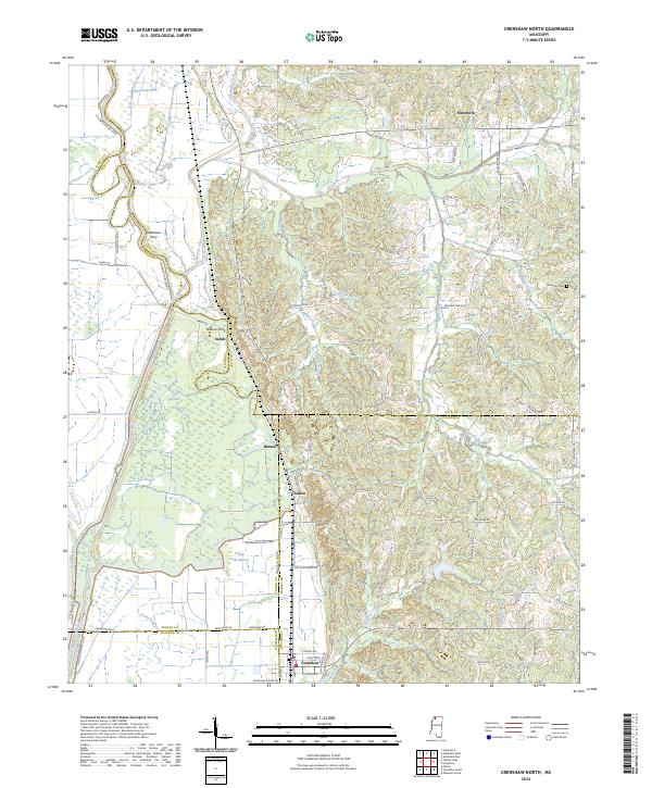
2024 Map of Crenshaw North
USGS Topo · Published 2024About this map
The Coldwater River and its intricate network of bayous and creeks define the borderlands where Tate, Tunica, and Panola counties converge. This landscape is characterized by the meandering path of Arkabutla Creek and the low-lying wetlands of Coon Bayou and Yellow Lake Bayou. The settlement of Crenshaw anchors the southern portion of the map, while smaller communities like Sarah, Askew, and Strayhorn are connected by a grid of rural roads and section lines. Notable local history landmarks include Matthews Ferry and Browns Ferry, signifying old river crossing points that once facilitated movement across the river's floodplain. The presence of the Harmony Cem near the eastern boundary offers a focal point for genealogical research in this largely agricultural region, where the interplay of water and land has dictated settlement patterns for generations.
Find a feature on this map
72 named features on this map. Tap any name to fly to it.
Don’t see what you’re looking for? This feature index may not catch every label — zoom into the map to look around manually.
Map Details
Editions of this 2024 Crenshaw North Map
This is the sole edition of this map. No revisions or reprints were ever made.
Other maps of this area

1908 · Hollywood
USGS Topo · 1:24,000

1908 · Walnut Lake
USGS Topo · 1:24,000

1910 · Walnut Lake
USGS Topo · 1:31,680

1913 · Hollywood
USGS Topo · 1:31,680

1932 · Sledge
USGS Topo · 1:48,000

1932 · Marks
USGS Topo · 1:48,000

1932 · Crenshaw
USGS Topo · 1:62,500

1935 · Marks
USGS Topo · 1:62,500

1935 · Crenshaw
USGS Topo · 1:62,500

1935 · Sledge
USGS Topo · 1:62,500