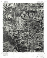
1975 Map of Senatobia NW
USGS Topo · Published 1976About this map
Coldwater River meanders across the northern portion of this 1970s orthophotoquad, defining a landscape of low-lying wetlands and dense vegetation that contrasts sharply with the nearby agricultural grid. The town of Coldwater sits along the western edge, positioned as a key settlement hub before the terrain descends into the river valley. To the south, the northern periphery of Senatobia is visible, showing the early stages of development and road infrastructure connecting these two Mississippi communities. Because this is an orthophotoquad, it provides a direct visual record of land use, from the cleared fields in the east to the winding, wooded riparian corridor that dictated the local drainage and settlement patterns during this era.
Find a feature on this map
3 named features on this map. Tap any name to fly to it.
Don’t see what you’re looking for? This feature index may not catch every label — zoom into the map to look around manually.
Map Details
Editions of this 1975 Senatobia NW Map
This is the sole edition of this map. No revisions or reprints were ever made.
Other maps of this area

1932 · Horn Lake
USGS Topo · 1:48,000

1932 · Crenshaw
USGS Topo · 1:62,500

1935 · Crenshaw
USGS Topo · 1:62,500

1935 · Horn Lake
USGS Topo · 1:62,500

1944 · Senatobia
USGS Topo · 1:62,500

1944 · Hernando
USGS Topo · 1:62,500

1948 · Helena
USGS Topo · 1:250,000

1950 · Helena
USGS Topo · 1:250,000

1955 · Helena
USGS Topo · 1:250,000

1956 · Tupelo
USGS Topo · 1:250,000