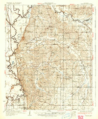
1932 Map of Crenshaw
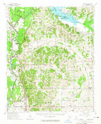
USGS Topo · Published 1964About this map
The Mississippi Valley floodplains meet the rising hills of the interior in this early 1930s survey, showing a landscape defined by the winding Coldwater River. The infrastructure reflects a rural society heavily organized around local institutions, with an exceptional density of country schools like the Ella Green Sch and Sandy Sch, alongside numerous spiritual hubs such as Hunters Chapel and the Latter Day Saints Ch. The Yazoo and Mississippi Valley RR cuts through the western lowlands, connecting the town of Crenshaw and the settlement at Askew to the wider Delta economy.
Find a feature on this map
87 named features on this map. Tap any name to fly to it.
Don’t see what you’re looking for? This feature index may not catch every label — zoom into the map to look around manually.
Map Details
Editions of this 1932 Crenshaw Map
This is the sole edition of this map. No revisions or reprints were ever made.
Historical Maps of Senatobia Through Time
3 maps found