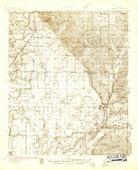
1932 Map of Sledge
USGS Topo · Published 1932About this map
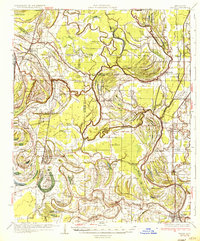
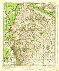
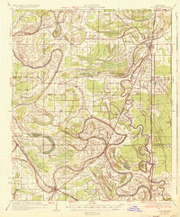
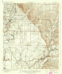
Sledge serves as a focal point in this early 1930s landscape, where the Yazoo and Mississippi Valley RR cuts through the fertile lowlands of the Mississippi Delta. The map documents a dense network of social and educational landmarks, from Melrose Sch and Harmonious Sch to numerous houses of worship like St John Ch and Swango Chapel. The terrain transitions from the intricate bayous and brakes of the west, such as Viney Bayou and Chinquapin Brake, toward the more elevated Rough country and the winding course of the Coldwater River. An early aviation footprint is visible at the Carrier Landing Field, while the Choctaw Chickasaw Boundary Line and the Choctaw Meridian provide a structural look at the historical surveying and land divisions that defined Quitman and Panola counties during this era of rural development.
Find a feature on this map
89 named features on this map. Tap any name to fly to it.
Don’t see what you’re looking for? This feature index may not catch every label — zoom into the map to look around manually.
Map Details
Editions of this 1932 Sledge Map
2 editions found
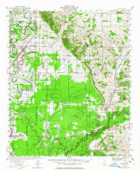
Other maps of this area

1908 · Walnut Lake
USGS Topo · 1:24,000

1910 · Walnut Lake
USGS Topo · 1:31,680
1932 · Tutwiler
USGS Topo · 1:48,000
1932 · Marks
USGS Topo · 1:48,000

1932 · Crenshaw
USGS Topo · 1:62,500

1935 · Crowder
USGS Topo · 1:62,500
1935 · Marks
USGS Topo · 1:62,500
1935 · Crenshaw
USGS Topo · 1:62,500
1935 · Tutwiler
USGS Topo · 1:62,500
1935 · Sledge
USGS Topo · 1:62,500