
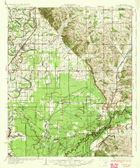
1935 Map of Sledge
USGS Topo · Published 1935About this map
The Tallahatchie River dominates the eastern half of this 1930s survey, winding through a complex network of bayous and oxbow lakes that define the border between Quitman and Panola counties. The agricultural landscape is densely populated with community landmarks, including small country schools like Mastodon Sch and New Bethel Sch, and numerous churches such as Mickins Chapel and Harmonious Sch. The town of Sledge serves as a primary hub, situated along the Yazoo and Mississippi Valley RR, which facilitated the transport of timber and crops from this alluvial plain.
Find a feature on this map
78 named features on this map. Tap any name to fly to it.
Don’t see what you’re looking for? This feature index may not catch every label — zoom into the map to look around manually.
Map Details
Editions of this 1935 Sledge Map
2 editions found
Other maps of this area

1908 · Walnut Lake
USGS Topo · 1:24,000

1910 · Walnut Lake
USGS Topo · 1:31,680

1932 · Sledge
USGS Topo · 1:48,000

1932 · Tutwiler
USGS Topo · 1:48,000

1932 · Marks
USGS Topo · 1:48,000

1932 · Crenshaw
USGS Topo · 1:62,500

1935 · Crowder
USGS Topo · 1:62,500

1935 · Marks
USGS Topo · 1:62,500

1935 · Crenshaw
USGS Topo · 1:62,500

1935 · Tutwiler
USGS Topo · 1:62,500