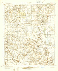
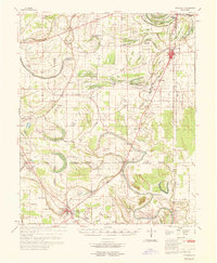
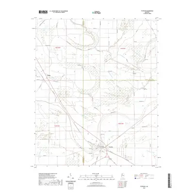
1932 Map of Tutwiler
USGS Topo · Published 1932About this map
Tutwiler and the surrounding Mississippi Delta landscape are defined by an intricate network of winding waterways and oxbow remnants during this early 1930s era. The Yazoo and Mississippi Valley Railroad serves as a primary north-south artery, passing through Lambert and Tutwiler while connecting smaller settlements like Brazil and Hiram. The rural social fabric is visible through dozens of small congregations and schools, including Whitfield Ch, Stover Ch, and the Shady Grove Sch. Significant land use patterns are revealed by the presence of State Farm Camp A and State Farm Camp B east of the rail line. The heavy meandering of Cassidy Bayou and features like Dam Slough and Forty Acre Brake indicate a terrain dominated by the complex drainage and seasonal overflows characteristic of the region before modern flood control reshaped the Delta.
Find a feature on this map
45 named features on this map. Tap any name to fly to it.
Don’t see what you’re looking for? This feature index may not catch every label — zoom into the map to look around manually.
Map Details
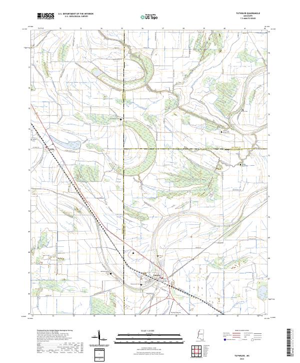
Editions of this 1932 Tutwiler Map
This is the sole edition of this map. No revisions or reprints were ever made.
Historical Maps of Marks Through Time
10 maps found
1932 Tutwiler
Tallahatchie County, MS
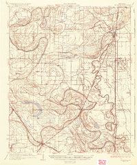
1935 Tutwiler
Tallahatchie County, MS
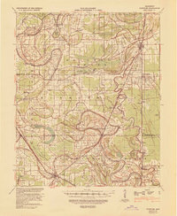
1939 Tutwiler
Tallahatchie County, MS
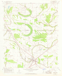
1967 Tutwiler
Tallahatchie County, MS
1969 Tutwiler
Tallahatchie County, MS
2012 Tutwiler
Tallahatchie County, MS
2015 Tutwiler
Tallahatchie County, MS
2018 Tutwiler
Tallahatchie County, MS
2020 Tutwiler
Tallahatchie County, MS
2024 Tutwiler
Tallahatchie County, MS