
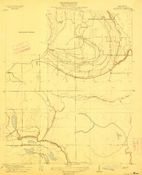
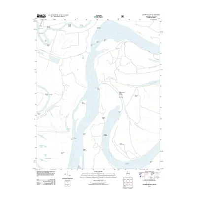
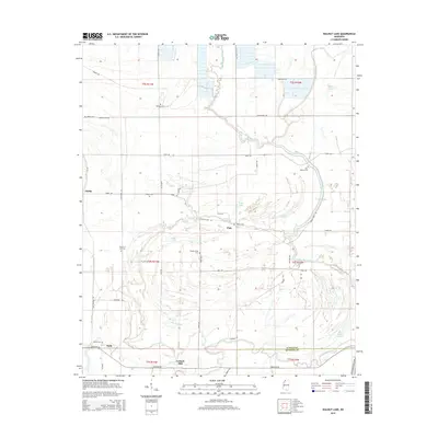
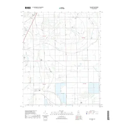
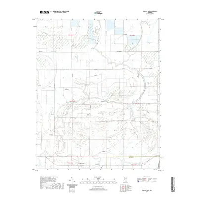
1910 Map of Walnut Lake
USGS Topo · Published 1910About this map
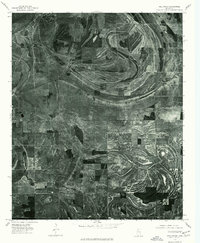
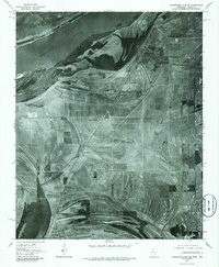
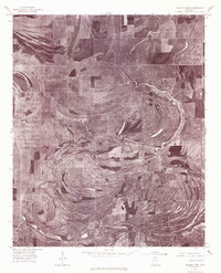
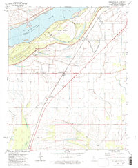
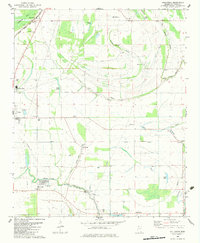
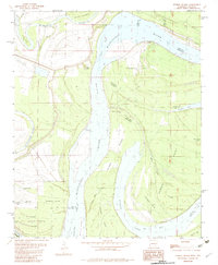
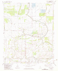
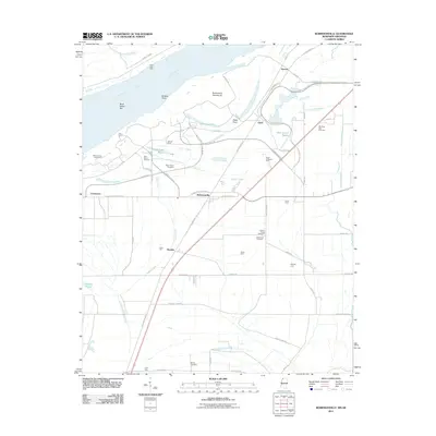
Whiteoak Bayou and the Coldwater River define this segment of the Mississippi Delta, surveyed shortly after the turn of the century by the Tallahatchie Drainage Commission. This era was characterized by significant efforts to manage the wetlands of Tunica and Quitman Counties, where the landscape is a network of crescent-shaped oxbow lakes and winding bayous. Small agrarian settlements and industrial sites like Gerlach Mill and Cox Camp sit along the high ground of the natural levees. The prominent arc of Walnut Lake is a focal point of the area, serving as the namesake for the Walnut Lake School. For genealogists and local historians, the map preserves the exact locations of smaller points such as Dubbs, Pink, and Hally, providing a clear view of the rural habitation patterns before modern agricultural industrialization fully reshaped the river basin.
Find a feature on this map
22 named features on this map. Tap any name to fly to it.
Don’t see what you’re looking for? This feature index may not catch every label — zoom into the map to look around manually.
Map Details
Editions of this 1910 Walnut Lake Map
This is the sole edition of this map. No revisions or reprints were ever made.
Historical Maps of Hally Through Time
35 maps found

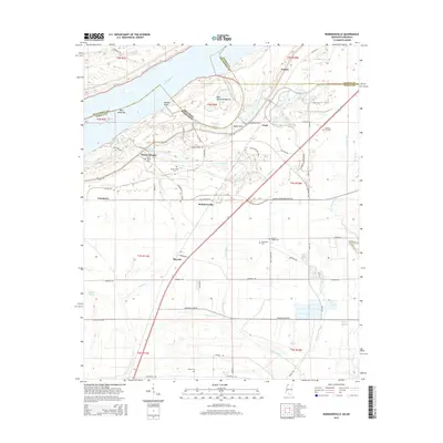
1908 Hollywood
Tunica County, MS

1908 Walnut Lake
Tunica County, MS
1910 Walnut Lake
Tunica County, MS
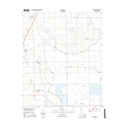
1913 Hollywood
Tunica County, MS
1939 Clayton
Tunica County, MS
1955 Clayton
Tunica County, MS
1975 Clayton NW
Tunica County, MS
1975 Hollywood
Tunica County, MS
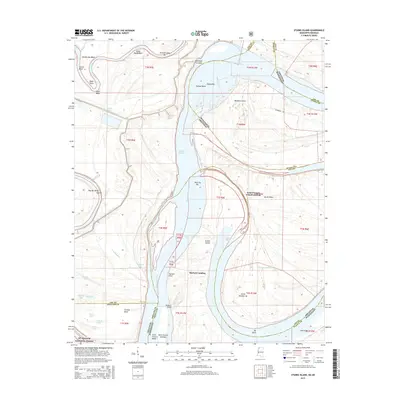
1975 Horseshoe Lake SE
Tunica County, MS
1975 Walnut Lake
Tunica County, MS
1981 Robinsonville
Tunica County, MS
1982 Hollywood
Tunica County, MS
1982 Stubbs Island
Tunica County, MS
1982 Walnut Lake
Tunica County, MS
2011 Robinsonville
Tunica County, MS
2011 Stubbs Island
Tunica County, MS
2012 Hollywood
Tunica County, MS
2012 Robinsonville
Tunica County, MS
2012 Walnut Lake
Tunica County, MS
2015 Hollywood
Tunica County, MS
2015 Robinsonville
Tunica County, MS
2015 Stubbs Island
Tunica County, MS
2015 Walnut Lake
Tunica County, MS
2018 Hollywood
Tunica County, MS
2018 Robinsonville
Tunica County, MS
2018 Stubbs Island
Tunica County, MS
2018 Walnut Lake
Tunica County, MS
2020 Hollywood
Tunica County, MS
2020 Robinsonville
Tunica County, MS
2020 Walnut Lake
Tunica County, MS
2021 Stubbs Island
Tunica County, MS
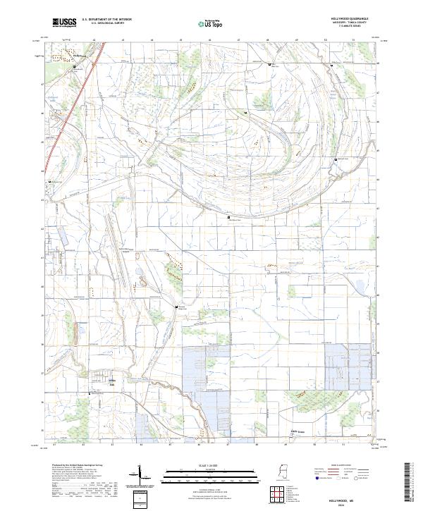
2024 Hollywood
Tunica County, MS
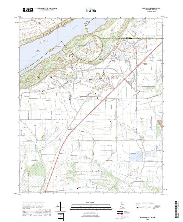
2024 Robinsonville
Tunica County, MS
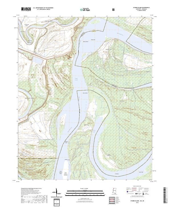
2024 Stubbs Island
Tunica County, MS
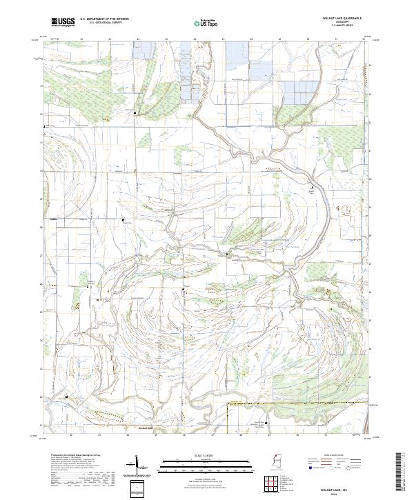
2024 Walnut Lake
Tunica County, MS