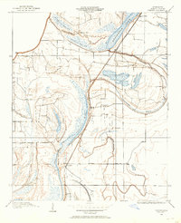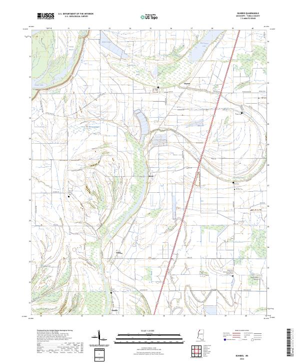
1910 Map of Dundee
USGS Topo · Published 1910About this map
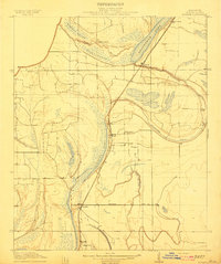
The Yazoo and Mississippi Valley R. R. serves as the primary corridor through this Mississippi Delta landscape, connecting the small agrarian hubs of Dundee and Maud. The terrain is defined by a complex network of wetlands and oxbow formations, including the expansive Beaverdam Lake and the serpentine curves of Beaverdam Bayou. These water features, alongside Cypress Lake and Bear Lake, dictate the placement of early 20th-century roads and rail lines, which must navigate the low-lying brakes and bayous.
Find a feature on this map
19 named features on this map. Tap any name to fly to it.
Don’t see what you’re looking for? This feature index may not catch every label — zoom into the map to look around manually.
Map Details
Editions of this 1910 Dundee Map
This is the sole edition of this map. No revisions or reprints were ever made.
Historical Maps of Hamlin Through Time
9 maps found