
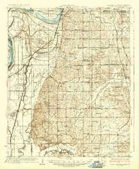
1935 Map of Horn Lake
USGS Topo · Published 1935About this map
Chickasaw Bluffs dominate the eastern landscape of this 1930s survey, marking the transition from the high terrace ground down to the intricate river bottoms of the Mississippi River. The region is defined by its complex hydrology, where Horn Lake and Cormorant Lake sit amidst a network of bayous and old river channels like Cormorant Bayou and Norfolk Bayou. This period shows a well-established agrarian society centered on small settlements and dozens of community anchors, such as Morning Star Ch, Bethlehem, and Eudora.
Find a feature on this map
101 named features on this map. Tap any name to fly to it.
Don’t see what you’re looking for? This feature index may not catch every label — zoom into the map to look around manually.
Map Details
Editions of this 1935 Horn Lake Map
2 editions found
Other maps of this area

1908 · Hollywood
USGS Topo · 1:24,000

1908 · Lake Cormorant
USGS Topo · 1:24,000

1912 · Lake Cormorant
USGS Topo · 1:31,680

1913 · Hollywood
USGS Topo · 1:31,680

1916 · Memphis
USGS Topo · 1:62,500

1925 · Memphis
USGS Topo · 1:48,000

1927 · Memphis
USGS Topo · 1:62,500

1931 · Horseshoe Lake
USGS Topo · 1:62,500

1932 · Horn Lake
USGS Topo · 1:48,000

1932 · Crenshaw
USGS Topo · 1:62,500