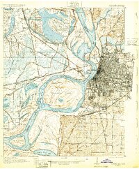
1925 Map of Memphis
USGS Topo · Published 1925About this map
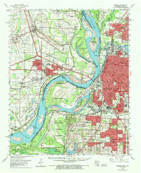
The Mississippi River creates a dynamic western boundary for Memphis, defining a landscape dominated by the massive Presidents Island and Chicken Island. In 1925, the Arkansas side is a network of protective structures like the St Francis Levee and numerous river landings including St Clair Landing and Mound City Landing. The era is defined by the heavy presence of major railroads such as the St Louis and San Francisco RR and the Chicago Rock Island and Pacific RR converging at Bridge Junction. Local life is visible through family-named landmarks like Bertons Store and community hubs like the Bethlehem School and Greens Hill Church. This survey, updated by the Bureau of Public Roads, shows early infrastructure projects including the Arkansas Federal Aid Project No. 95 (Concrete) and a Proposed Viaduct, marking the transition from river-and-rail dominance to modern highway development.
Find a feature on this map
105 named features on this map. Tap any name to fly to it.
Don’t see what you’re looking for? This feature index may not catch every label — zoom into the map to look around manually.
Map Details
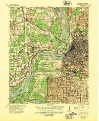
Editions of this 1925 Memphis Map
This is the sole edition of this map. No revisions or reprints were ever made.
Historical Maps of Memphis Through Time
8 maps found