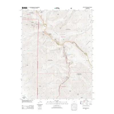
2013 Map of Crestone Peak
USGS Topo · Published 2013About this map
Crestone Peak and the surrounding high-altitude terrain of the Sangre de Cristo Range dominate this high-resolution study, where the borders of the Rio Grande National Forest and San Isabel National Forest meet. This alpine landscape is defined by its collection of fourteeners and named summits, including Kit Carson Mountain, Challenger Point, and the sharp profile of Crestone Needle. The geography transitions from these jagged heights into the protected lands of the Great Sand Dunes National Preserve. Historically significant trails, such as the Rainbow Trail and the South Colony Trail, provide the primary access to remote water bodies like Willow Lake and South Colony Lakes. The presence of Music Pass and Music Mountain suggests the traditional travel corridors used to navigate between the high peaks and the sand dunes below.
Find a feature on this map
65 named features on this map. Tap any name to fly to it.
Don’t see what you’re looking for? This feature index may not catch every label — zoom into the map to look around manually.
Map Details
Editions of this 2013 Crestone Peak Map
This is the sole edition of this map. No revisions or reprints were ever made.
Other maps of this area

1889 · Canon City
USGS Topo · 1:125,000

1889 · Huerfano Park
USGS Topo · 1:125,000

1892 · Huerfano Park
USGS Topo · 1:125,000

1892 · Canon City
USGS Topo · 1:125,000

1954 · Trinidad
USGS Topo · 1:250,000

1954 · Pueblo
USGS Topo · 1:250,000

1955 · Trinidad
USGS Topo · 1:250,000

1957 · Pueblo
USGS Topo · 1:250,000

1957 · Aldrich Gulch
USGS Topo · 1:24,000

1958 · Trinidad
USGS Topo · 1:250,000