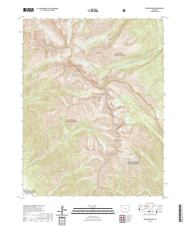
2022 Map of Crestone Peak
USGS Topo · Published 2022About this map
Crestone Peak and its sister summits dominate the skyline at the meeting of Saguache and Custer counties. This high-altitude landscape is characterized by a network of glacial tarns and alpine basins, where North Colony Lakes and Willow Lake feed the drainages that descend toward the valley floors. The convergence of San Isabel National Forest, Rio Grande National Forest, and the Great Sand Dunes National Preserve marks a complex jurisdictional landscape centered on the crest of the Sangre de Cristo Range.
Find a feature on this map
69 named features on this map. Tap any name to fly to it.
Don’t see what you’re looking for? This feature index may not catch every label — zoom into the map to look around manually.
Map Details
Editions of this 2022 Crestone Peak Map
This is the sole edition of this map. No revisions or reprints were ever made.
Other maps of this area

1889 · Canon City
USGS Topo · 1:125,000

1889 · Huerfano Park
USGS Topo · 1:125,000

1892 · Huerfano Park
USGS Topo · 1:125,000

1892 · Canon City
USGS Topo · 1:125,000

1954 · Trinidad
USGS Topo · 1:250,000

1954 · Pueblo
USGS Topo · 1:250,000

1955 · Trinidad
USGS Topo · 1:250,000

1957 · Pueblo
USGS Topo · 1:250,000

1957 · Aldrich Gulch
USGS Topo · 1:24,000

1958 · Trinidad
USGS Topo · 1:250,000