
1966 Map of Crosbyton
USGS Topo · Published 1968About this map
Crosbyton stands at the western edge of the dramatic Blanco Canyon landscape, where the flat High Plains suddenly break into the breaks of the White River. This mid-1960s survey captures the town as a regional hub, showing the street grid alongside the Atchison Topeka and Santa Fe railroad line. The map illustrates a community shaped by its geography, with local infrastructure like the Paudler Airfield, Fairground, and a Sewage Disposal plant situated on the level ground above the canyon.
Find a feature on this map
23 named features on this map. Tap any name to fly to it.
Don’t see what you’re looking for? This feature index may not catch every label — zoom into the map to look around manually.
Map Details
Editions of this 1966 Crosbyton Map
This is the sole edition of this map. No revisions or reprints were ever made.
Other maps of this area

1954 · Lubbock
USGS Topo · 1:250,000

1961 · Bunker Hill
USGS Topo · 1:24,000

1965 · Floydada SE
USGS Topo · 1:24,000

1965 · Wake
USGS Topo · 1:24,000

1966 · Mount Blanco
USGS Topo · 1:24,000

1966 · McAdoo
USGS Topo · 1:24,000

1966 · Collett Springs
USGS Topo · 1:24,000

1967 · Ralls SE
USGS Topo · 1:24,000

1967 · Ralls NE
USGS Topo · 1:24,000
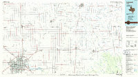
1986 · Lubbock
USGS Topo · 1:100,000