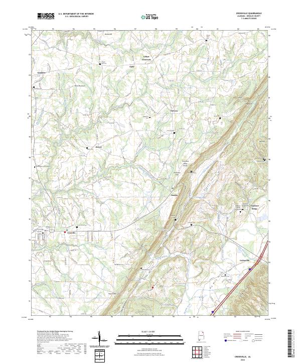
2024 Map of Crossville
USGS Topo · Published 2024About this map
Sand Mountain dominates the western half of this DeKalb County landscape, where the plateau surface supports established communities like Geraldine, Skirum, and Crossville. The terrain is defined by the Tennessee Valley Divide, which separates the drainages of Scarham Creek flowing northwest from the parallel ridges and valleys to the southeast. Here, the land drops away into Big Wills Valley and Dugout Valley, creating a distinct contrast between the broad upland farming areas and the narrow, tucked-away corridors of Little Sand Valley Creek.
Find a feature on this map
140 named features on this map. Tap any name to fly to it.
Don’t see what you’re looking for? This feature index may not catch every label — zoom into the map to look around manually.
Map Details
Editions of this 2024 Crossville Map
This is the sole edition of this map. No revisions or reprints were ever made.
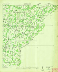
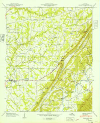
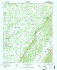
Historical Maps of Dawson Through Time
4 maps found