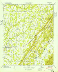
1949 Map of Crossville
USGS Topo · Published 1949About this map
Sand Mountain dominates this 1949 topographic study, where agricultural development and rural settlement patterns are clearly defined on the high plateau. The Sand Mountain Agricultural Experiment Sta stands near the center of the sheet, reflecting the area's importance to Alabama's farming research during this period. At the base of the steep eastern escarpment, the landscape drops dramatically into Big Wills Valley, a transition marked by natural landmarks like Griffin Falls and Swindell Falls.
Find a feature on this map
50 named features on this map. Tap any name to fly to it.
Don’t see what you’re looking for? This feature index may not catch every label — zoom into the map to look around manually.
Map Details
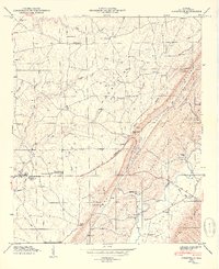
Editions of this 1949 Crossville Map
2 editions found
Other maps of this area

1885 · Gadsden
USGS Topo · 1:125,000

1888 · Gadsden
USGS Topo · 1:125,000

1892 · Gadsden
USGS Topo · 1:125,000

1893 · Fort Payne
USGS Topo · 1:125,000

1895 · Gadsden
USGS Topo · 1:125,000

1898 · Fort Payne
USGS Topo · 1:125,000

1900 · Fort Payne
USGS Topo · 1:125,000

1903 · Gadsden
USGS Topo · 1:125,000

1936 · Painter
USGS Topo · 1:24,000

1936 · Crossville
USGS Topo · 1:24,000