
Loading...
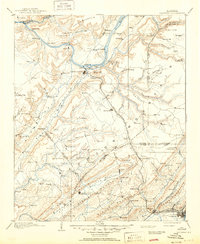
Loading map...1895 Map of Gadsden
USGS Topo · Published 1895About this map
Gunter Mountain and the steep ridges of Lookout Mountain define the topography of this Northeast Alabama region during the late nineteenth century. The Tennessee River serves as a primary corridor for commerce, noted by riverside infrastructure like Coal Landing and Lovelace Landing. These points, along with multiple ferry crossings, suggest a river-dependent economy still vital before modern bridging.
Find a feature on this map
155 named features on this map. Tap any name to fly to it.
Don’t see what you’re looking for? This feature index may not catch every label — zoom into the map to look around manually.
Map Details
Date Portrayed1895
Date Published1895
PublisherU.S. Geological Survey
Map TypeTopographic
Scale1:125,000
Physical Dimensions16.8 x 20.2 inches
Editions of this 1895 Gadsden Map
This is the sole edition of this map. No revisions or reprints were ever made.
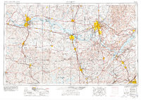
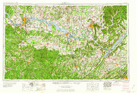
Historical Maps of Gadsden Through Time
9 maps found


Featured Locations
Source Details
SourceU.S. Geological Survey
CopyrightPublic Domain