
Loading...
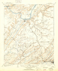
Loading map...1888 Map of Gadsden
USGS Topo · Published 1888About this map
The Tennessee River winds through the heart of this 1880s survey, anchoring a landscape of river-based commerce and developing rail corridors. Near the river bend, Guntersville and Warrenton serve as primary hubs, while numerous river access points like Law's Landing, Love Lace Landing, and Coal Landing reflect the era's dependence on waterway transport. The terrain is defined by the significant rise of Sand Mountain and the deep incision of Buck's Pocket in the northeast.
Find a feature on this map
111 named features on this map. Tap any name to fly to it.
Don’t see what you’re looking for? This feature index may not catch every label — zoom into the map to look around manually.
Map Details
Date Portrayed1888
Date Published1888
PublisherU.S. Geological Survey
Map TypeTopographic
Scale1:125,000
Physical Dimensions16.5 x 19.9 inches
Editions of this 1888 Gadsden Map
This is the sole edition of this map. No revisions or reprints were ever made.
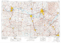
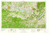
Historical Maps of Gadsden Through Time
9 maps found


Featured Locations
Source Details
SourceU.S. Geological Survey
CopyrightPublic Domain