Loading...
Loading map...2024 Map of Cruger
USGS Topo · Published 2024About this map
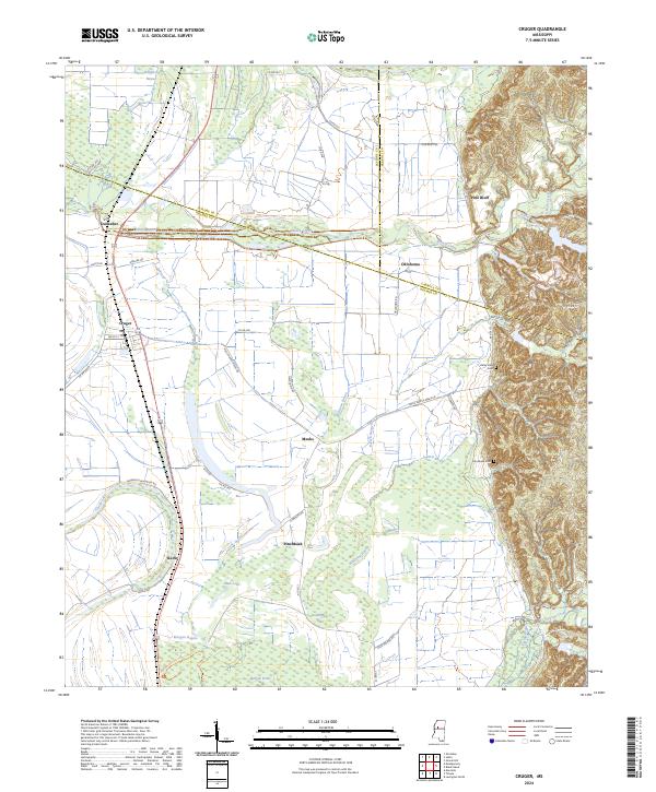
Mathews Brake National Wildlife Refuge and Morgan Brake National Wildlife Refuge anchor the lowlands of this Holmes County landscape, where the flat alluvial plains of the Mississippi Delta meet the rising bluffs to the east. The settlement of Cruger sits at the intersection of local commerce and the rail corridor, while smaller communities like Meeks, Pinchback, and Oklahoma are scattered across the drainage basins of Abiaca Creek and Millstone Bayou.
Find a feature on this map
62 named features on this map. Tap any name to fly to it.
Don’t see what you’re looking for? This feature index may not catch every label — zoom into the map to look around manually.
Map Details
Date Portrayed2024
Date Published2024
PublisherU.S. Geological Survey
Map TypeTopographic
Scale1:24000
Physical Dimensions24 x 29 inches
Editions of this 2024 Cruger Map
This is the sole edition of this map. No revisions or reprints were ever made.
Historical Maps of Pine Bluff Through Time
Featured Locations
Source Details
SourceU.S. Geological Survey
CopyrightPublic Domain