2023 Map of Crumpler
USGS Topo · Published 2023About this map
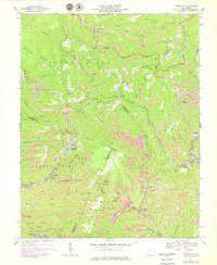
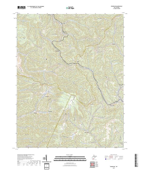
Crumpler and Ashland anchor this survey of the coalfields where McDowell, Mercer, and Wyoming counties meet. The landscape is defined by its deep hollows and high ridges, including Beartown Ridge and Pinnacle Ridge, which historically dictated the paths of transit and settlement. The density of small settlements like Smokeless, Giatto, and Weyanoke reflects the region's industrial heritage, linked by a winding network of roads such as the Northfork-Ashland Rd and Windmill Gap Rd. Family history is marked at sites like Bailey Cem and Prosperity Cem, while the rugged hydrology is traced by the North Fork Elkhorn Creek and the Lefthand Fork Widemouth Creek. This map captures the intricate topography where local communities established themselves along narrow creek beds under the shadow of peaks like Pilot Knob and Johns Knob.
Find a feature on this map
107 named features on this map. Tap any name to fly to it.
Don’t see what you’re looking for? This feature index may not catch every label — zoom into the map to look around manually.
Map Details
Editions of this 2023 Crumpler Map
This is the sole edition of this map. No revisions or reprints were ever made.