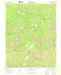
1967 Map of Crumpler
USGS Topo · Published 1979About this map
Crumpler and the surrounding coal camps of McDowell, Wyoming, and Mercer Counties define this 1967 survey, showing the intensive industrial landscape of the West Virginia southern coalfields. The terrain is dominated by the ridges of Flat Top Mountain and Barkers Ridge, where the extraction economy is evident through numerous Strip Mines, Mine Dumps, and a Tipple near Arista. This era of the late 1960s captures the reliance on the Norfolk and Western railway lines that wind through narrow valleys, connecting settlements like Ashland, McComas, and Weyanoke. Social life is anchored by local landmarks such as Beartown Ch and Prosperity Sch, while the Pilot Knob Lookout Tower stands as a sentinel over the heavily modified landscape. The map provides a detailed view of the infrastructure supporting these mountain communities, from the intricate network of Mine portals to the branching creek beds of North Fork Elkhorn Creek and Crane Creek.
Find a feature on this map
66 named features on this map. Tap any name to fly to it.
Don’t see what you’re looking for? This feature index may not catch every label — zoom into the map to look around manually.
Map Details
Editions of this 1967 Crumpler Map
2 editions found
Other maps of this area

1887 · Pocahontas
USGS Topo · 1:125,000

1891 · Pocahontas
USGS Topo · 1:125,000

1891 · Raleigh
USGS Topo · 1:125,000

1894 · Pocahontas
USGS Topo · 1:125,000

1895 · Pocahontas
USGS Topo · 1:125,000

1897 · Raleigh
USGS Topo · 1:125,000

1902 · Raleigh
USGS Topo · 1:125,000

1909 · Pocahontas Special
USGS Topo · 1:48,000

1911 · Flattop
USGS Topo · 1:48,000

1911 · Pocahontas Special
USGS Topo · 1:62,500