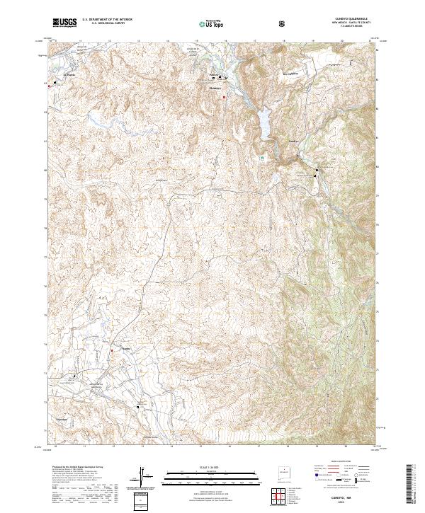
2023 Map of Cundiyo
USGS Topo · Published 2023About this map
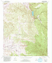
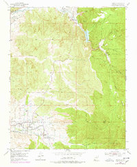
Chimayo and the historic settlement of Potrero anchor the northern landscape of this Santa Fe County study, where the Santa Cruz River and the La Puebla Ditch trace the traditional irrigation patterns of the valley. The map documents a high density of cultural and religious sites, most notably the El Santuario pilgrimage site and its associated El Santuario Cem. To the south, the terrain transitions toward the traditional lands of Nambe and Pojoaque, revealing the complex network of local roads like Juan Medina Rd and Cundiyo Rd that connect these dispersed communities.
Find a feature on this map
72 named features on this map. Tap any name to fly to it.
Don’t see what you’re looking for? This feature index may not catch every label — zoom into the map to look around manually.
Map Details
Editions of this 2023 Cundiyo Map
This is the sole edition of this map. No revisions or reprints were ever made.
Historical Maps of La Puebla Through Time
3 maps found