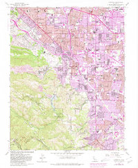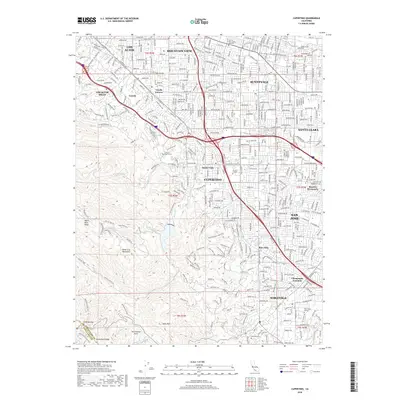
1953 Map of Cupertino
USGS Topo · Published 1955About this map
Permanente Cement Plant and its sprawling quarry dominate the eastern slopes of the Santa Cruz Mts, illustrating the industrial scale of post-war California. This early 1950s landscape shows the transition from orchard-lined country roads to suburban development, with the Southern Pacific line threading through Los Altos and Loyola Corners. The western half is defined by the steep topography of the Monte Bello Ridge and the San Andreas Rift Zone, where the Stevens Creek Reservoir captures runoff from the surrounding peaks. Local education and religious institutions are prominent features, including the St Josephs and Maryknoll seminaries, alongside numerous neighborhood schools like Collins Sch and Lincoln Sch. The map records the early footprints of Cupertino and Saratoga before the full expansion of the Santa Clara Valley's urban corridor.
Find a feature on this map
61 named features on this map. Tap any name to fly to it.
Don’t see what you’re looking for? This feature index may not catch every label — zoom into the map to look around manually.
Map Details
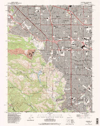
Editions of this 1953 Cupertino Map
This is the sole edition of this map. No revisions or reprints were ever made.
Historical Maps of San Jose Through Time
7 maps found