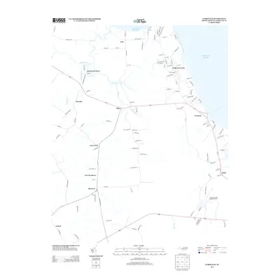
2013 Map of Currituck
USGS Topo · Published 2013About this map
Shawboro and the nearby Currituck County Regional Airport anchor the southern portion of this coastal North Carolina landscape. The region is defined by a dense network of slow-moving waterways and marshes that feed into the Atlantic Ocean, including Tull Cr, Buckskin Cr, and the East Canal. Small residential developments like Beechwood Shores and Wedgewood Lakes appear alongside long-standing crossroads settlements such as Sligo and Maple. A series of family-named roads, like Poyners Rd and N Lou Sawyer Rd, suggests a deep-rooted local history. The map illustrates how modern infrastructure, such as the Currituck community hub, integrates with the natural drainage patterns of the coastal plain, where the flat elevation is punctuated by local landmarks like Corner Gum and New Providence.
Find a feature on this map
110 named features on this map. Tap any name to fly to it.
Don’t see what you’re looking for? This feature index may not catch every label — zoom into the map to look around manually.
Map Details
Editions of this 2013 Currituck Map
This is the sole edition of this map. No revisions or reprints were ever made.
Other maps of this area

1893 · Virginia Beach
USGS Topo · 1:125,000

1916 · Back Bay
USGS Topo · 1:62,500

1939 · Moyock
USGS Topo · 1:62,500

1940 · Barco
USGS Topo · 1:62,500

1943 · Back Bay
USGS Topo · 1:62,500

1946 · Moyock
USGS Topo · 1:62,500

1946 · Eastville
USGS Topo · 1:250,000

1946 · Currituck Sound
USGS Topo · 1:250,000

1948 · Elizabeth City
USGS Topo · 1:62,500

1953 · Norfolk
USGS Topo · 1:250,000