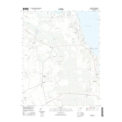
2016 Map of Currituck
USGS Topo · Published 2016About this map
Currituck and the surrounding coastal plains of northeast North Carolina define this landscape of water and low-lying wetlands. The terrain is a complex network of marshes and slow-moving waterways, including the expansive Great Swamp and Black Swamp in the southern reaches. Settlement is concentrated along the higher ground following the road networks, where small communities like Shawboro, Sligo, and Maple are established. The map captures the meeting of land and sea at Tull Bay, while the Intracoastal Waterway runs along the eastern edge, emphasizing the region's historical and modern reliance on maritime transit. The presence of the Currituck County Regional Airport near Maple contrasts with the surrounding rural character, indicating the area's role as a regional hub within the tidewater country.
Find a feature on this map
90 named features on this map. Tap any name to fly to it.
Don’t see what you’re looking for? This feature index may not catch every label — zoom into the map to look around manually.
Map Details
Editions of this 2016 Currituck Map
This is the sole edition of this map. No revisions or reprints were ever made.
Other maps of this area

1893 · Virginia Beach
USGS Topo · 1:125,000

1916 · Back Bay
USGS Topo · 1:62,500

1939 · Moyock
USGS Topo · 1:62,500

1940 · Barco
USGS Topo · 1:62,500

1943 · Back Bay
USGS Topo · 1:62,500

1946 · Moyock
USGS Topo · 1:62,500

1946 · Eastville
USGS Topo · 1:250,000

1946 · Currituck Sound
USGS Topo · 1:250,000

1948 · Elizabeth City
USGS Topo · 1:62,500

1953 · Norfolk
USGS Topo · 1:250,000