2024 Map of Dade City
USGS Topo · Published 2024About this map
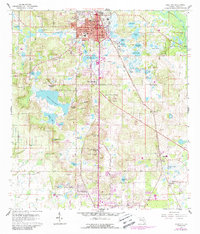
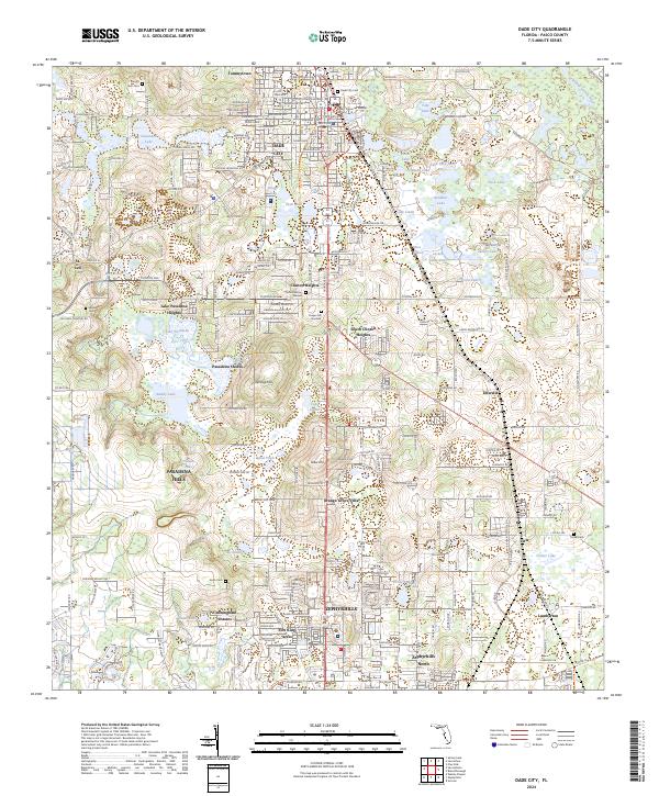
Dade City and Zephyrhills anchor this part of Pasco County, where the landscape is defined by a dense network of lakes and low-lying wetlands. The northeastern corner is bounded by the winding Withlacoochee River, while numerous named basins like Suwannee Lake, Duck Lake, and Lake Pasadena dot the terrain. The area's historical footprint is visible through its many burial grounds, including the Dade City Cemetery, Mount Zion Cemetery, and Floral Memory Gardens. The map illustrates a developed corridor between major towns, featuring communities like Tommytown, Clinton Heights, and Pasadena Hills. Topographically, the region is punctuated by small elevations such as LeHeup Hill and Greer Hill, which rise above the surrounding lake-strewn plains. The presence of the Robert D Sumner Judicial Center and several churches like Wesley Chapel marks the modern civic and social centers of the county.
Find a feature on this map
139 named features on this map. Tap any name to fly to it.
Don’t see what you’re looking for? This feature index may not catch every label — zoom into the map to look around manually.
Map Details
Editions of this 2024 Dade City Map
This is the sole edition of this map. No revisions or reprints were ever made.