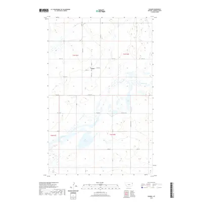
2020 Map of Dagmar
USGS Topo · Published 2020About this map
Dagmar serves as the primary settlement within this Sheridan County landscape, situated at the intersection of Madsen St and Lodahl St. The area is defined by a dense network of prairie lakes and wetlands, most notably Katy Lake and Long Lake, which are interconnected by the winding course of Lake Creek. These water bodies dominate the southern and eastern portions of the township, creating a distinctive hydrologic pattern of glacial potholes and permanent ponds like Mallard Pond.
Find a feature on this map
24 named features on this map. Tap any name to fly to it.
Don’t see what you’re looking for? This feature index may not catch every label — zoom into the map to look around manually.
Map Details
Editions of this 2020 Dagmar Map
This is the sole edition of this map. No revisions or reprints were ever made.
Other maps of this area

1946 · Brush Lake
USGS Topo · 1:24,000

1946 · Dagmar
USGS Topo · 1:24,000

1947 · Capeneys Lake
USGS Topo · 1:24,000

1948 · Capeneys Lake
USGS Topo · 1:24,000

1948 · Dagmar
USGS Topo · 1:24,000

1948 · Brush Lake
USGS Topo · 1:24,000

1948 · Reserve SE
USGS Topo · 1:24,000

1948 · Sunnyhill School
USGS Topo · 1:24,000

1949 · Reserve SE
USGS Topo · 1:24,000

1949 · Sunnyhill School
USGS Topo · 1:24,000