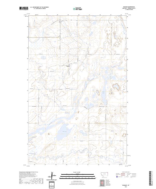
2024 Map of Dagmar
USGS Topo · Published 2024About this map
Dagmar stands as the primary settlement in this corner of Sheridan County, where a network of local roads like Madsen Rd and Hiawatha Rd connect the scattered agricultural tracts. The landscape is defined by its extensive wetlands and conservation efforts, dominated by the Medicine Lake National Wildlife Refuge and several units of the Sheridan County Waterfowl Production Area. These protected zones surround numerous glacial water bodies, including Brush Lake and the elongated Long Lake. The meandering paths of Lake Creek and Cottonwood Creek further emphasize the hydrological character of the prairie. This survey captures the modern rural infrastructure of the High Plains, where residential life in Dagmar is closely tied to the surrounding natural resources and the established section lines of the Public Land Survey System.
Find a feature on this map
27 named features on this map. Tap any name to fly to it.
Don’t see what you’re looking for? This feature index may not catch every label — zoom into the map to look around manually.
Map Details
Editions of this 2024 Dagmar Map
This is the sole edition of this map. No revisions or reprints were ever made.
Other maps of this area

1946 · Brush Lake
USGS Topo · 1:24,000

1946 · Dagmar
USGS Topo · 1:24,000

1947 · Capeneys Lake
USGS Topo · 1:24,000

1948 · Capeneys Lake
USGS Topo · 1:24,000

1948 · Dagmar
USGS Topo · 1:24,000

1948 · Brush Lake
USGS Topo · 1:24,000

1948 · Reserve SE
USGS Topo · 1:24,000

1948 · Sunnyhill School
USGS Topo · 1:24,000

1949 · Reserve SE
USGS Topo · 1:24,000

1949 · Sunnyhill School
USGS Topo · 1:24,000