2022 Map of Daleville
USGS Topo · Published 2022About this map
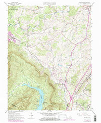
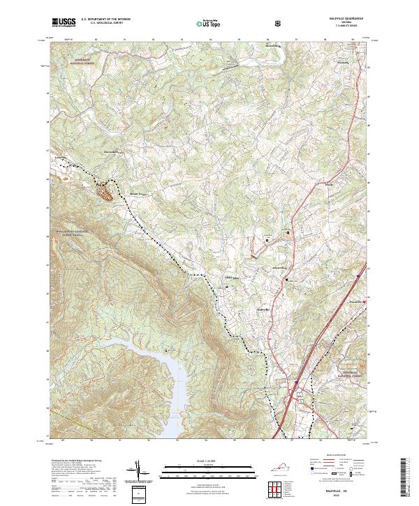
Fincastle, the historic county seat of Botetourt County, anchors the northern portion of this landscape where the ridge-and-valley terrain transitions into agricultural and residential corridors. The map documents the continued growth of Daleville and Troutville along the primary transportation routes, contrasted by the protected wilderness of the Jefferson National Forest. This modern survey traces the winding course of Catawba Creek and the expansive waters of the Carvin Cove Reservoir at the southern edge, while highlighting long-standing community landmarks like Glebe Mills and the Botetourt County Courthouse. Local heritage is preserved in numerous family and community burial sites, including Boyer Cem and Forest Chapel Cem. The Appalachian National Scenic Trail traverses the crests of Tinker Mtn and Brushy Mtn, marking the western and southern boundaries of this Appalachian corridor.
Find a feature on this map
155 named features on this map. Tap any name to fly to it.
Don’t see what you’re looking for? This feature index may not catch every label — zoom into the map to look around manually.
Map Details
Editions of this 2022 Daleville Map
This is the sole edition of this map. No revisions or reprints were ever made.
Historical Maps of Amsterdam Through Time
3 maps found