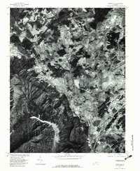
1977 Map of Daleville
USGS Topo · Published 1983About this map
Tinker Mountain and Brushy Mountain dominate the southwestern landscape of this orthophotoquad, where steep, forested ridges give way to the intricate valley settlements of Botetourt County. The imagery reveals the spatial relationship between the Carvin Cove Reservoir and the developing communities of Daleville and Troutville during the late 1970s.
Find a feature on this map
15 named features on this map. Tap any name to fly to it.
Don’t see what you’re looking for? This feature index may not catch every label — zoom into the map to look around manually.
Map Details
Editions of this 1977 Daleville Map
This is the sole edition of this map. No revisions or reprints were ever made.
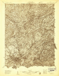
Other maps of this area

1887 · Lewisburg
USGS Topo · 1:125,000

1890 · Roanoke
USGS Topo · 1:125,000

1890 · Christiansburg
USGS Topo · 1:125,000

1891 · Roanoke
USGS Topo · 1:125,000

1891 · Lewisburg
USGS Topo · 1:125,000

1894 · Natural Bridge
USGS Topo · 1:125,000

1913 · Eagle Rock
USGS Topo · 1:48,000

1915 · Eagle Rock
USGS Topo · 1:62,500
1929 · Roanoke
USGS Topo · 1:48,000

1929 · Salem
USGS Topo · 1:48,000