
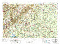
1890 Map of Roanoke
USGS Topo · Published 1890About this map
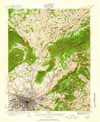
Roanoke serves as the central hub of this late 19th-century landscape, positioned where the Roanoke River meets a complex network of iron and coal interests like the Rorer Mines and Lynchburg Mines. The geography is defined by prominent ridges including Tinker Mountain and Porters Mountain, which hem in a series of agricultural and industrial settlements. Transportation is dominated by the intersection of the Shenandoah Valley Railroad and the Norfolk and Western Railroad, while rural commerce relies on numerous river crossings such as Hales Bridge and Blackwater Ford. Local life is anchored by landmarks like the Hollins Inst. Botetourt Sprs. and various country parishes, including Emmaus Church and Diamond Hill Church. The abundance of named mills, such as Dillons Mill and Meadows Mill, indicates a decentralized milling economy sustained by the many creeks branching through the Blue Ridge foothills.
Find a feature on this map
217 named features on this map. Tap any name to fly to it.
Don’t see what you’re looking for? This feature index may not catch every label — zoom into the map to look around manually.
Map Details
Editions of this 1890 Roanoke Map
This is the sole edition of this map. No revisions or reprints were ever made.
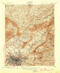
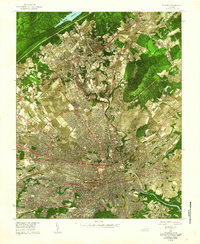
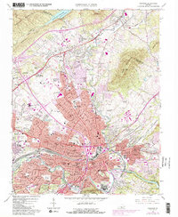
Historical Maps of Roanoke Through Time
11 maps found
1890 Roanoke
Roanoke City County, VA
1929 Roanoke
Roanoke City County, VA
1933 Roanoke
Roanoke City County, VA

1947 Roanoke
Roanoke City County, VA

1959 Roanoke
Roanoke City County, VA
1962 Roanoke
Roanoke City County, VA

1963 Roanoke
Roanoke City County, VA
1963 Roanoke
Roanoke City County, VA
1971 Roanoke
Roanoke City County, VA
1977 Roanoke
Roanoke City County, VA
2022 Roanoke
Roanoke City County, VA