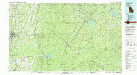
1981 Map of Dalton
USGS Topo · Published 1982About this map
The Blue Ridge mountains dominate the eastern half of this 1980s landscape, where the Chattahoochee National Forest meets the rugged peaks of the Cohutta Mountain range. To the west, the industrial and textile hub of Dalton anchors the valley floor, connected to regional trade centers like Chatsworth and Calhoun by a dense network of roads and the L & N and Southern railroads. This era shows the region's transition into a major outdoor recreation destination, with the sprawling waters of Carters Lake and Blue Ridge Lake providing significant hydropower and leisure infrastructure alongside established preserves like Fort Mountain State Park.
Find a feature on this map
175 named features on this map. Tap any name to fly to it.
Don’t see what you’re looking for? This feature index may not catch every label — zoom into the map to look around manually.
Map Details
Editions of this 1981 Dalton Map
This is the sole edition of this map. No revisions or reprints were ever made.
Other maps of this area

1886 · Dalton
USGS Topo · 1:125,000

1886 · Cleveland
USGS Topo · 1:125,000

1886 · Ringgold
USGS Topo · 1:125,000

1886 · Rome
USGS Topo · 1:125,000

1886 · Dahlonega
USGS Topo · 1:125,000

1888 · Ellijay
USGS Topo · 1:125,000

1888 · Chattanooga
USGS Topo · 1:125,000

1890 · Suwanee
USGS Topo · 1:125,000

1890 · Cartersville
USGS Topo · 1:125,000

1891 · Gainesville
USGS Topo · 1:125,000