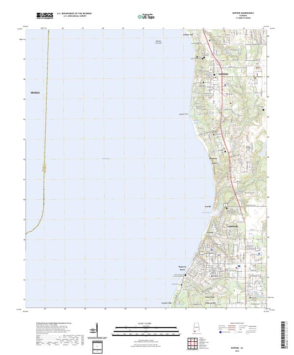
2024 Map of Daphne
USGS Topo · Published 2024About this map
Jackson Oak stands as a significant natural landmark near the shoreline of Mobile Bay, anchoring a landscape where the Eastern Shore's high bluffs meet the water. This modern survey detail shows the established residential patterns of Daphne and Fairhope, connected by the historic corridor of Old Spanish Trl. The map is particularly dense with genealogical sites, from the Yancey Crane Cem and Stokes - Yuille Family Cem in the north to the Tatumville Cem near the southern boundary. Complex coastal drainage systems are evident through Stack Gully and Tatumville Gully, while the presence of the Fairhope Colony Cem reflects the area's unique settlement history as a single-tax colony. The transition from the bay's edge at Red Bluff and Ragged Point to the interior neighborhoods illustrates the long-standing appeal of these coastal terraces.
Find a feature on this map
170 named features on this map. Tap any name to fly to it.
Don’t see what you’re looking for? This feature index may not catch every label — zoom into the map to look around manually.
Map Details
Editions of this 2024 Daphne Map
This is the sole edition of this map. No revisions or reprints were ever made.
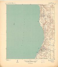
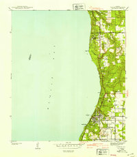
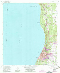
Historical Maps of Jackson Oak Through Time
4 maps found