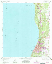
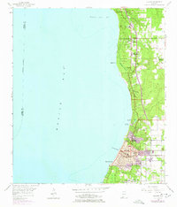
1953 Map of Daphne
USGS Topo · Published 1983About this map
Mobile Bay defines the western edge of this coastal survey, where the bluffs of Daphne and Fairhope overlook the eastern shore. The geography of the early 1950s is captured here, showing the development of these waterfront communities alongside established landmarks like Jackson Oak and Red Bluff. Coastal features such as Ragged Point and the complex wetlands of Campbell Swamp and Titi Swamp separate the more densely settled areas from the bay waters.
Find a feature on this map
40 named features on this map. Tap any name to fly to it.
Don’t see what you’re looking for? This feature index may not catch every label — zoom into the map to look around manually.
Map Details
Editions of this 1953 Daphne Map
5 editions found
Other maps of this area

1921 · Point Clear
USGS Topo · 1:62,500

1921 · Fairhope
USGS Topo · 1:62,500

1921 · Delchamps
USGS Topo · 1:62,500

1922 · Mobile
USGS Topo · 1:62,500

1939 · Daphne
USGS Topo · 1:31,680

1940 · Silverhill
USGS Topo · 1:31,680

1940 · Hollingers Island
USGS Topo · 1:31,680

1940 · Mobile
USGS Topo · 1:31,680

1940 · Mobile
USGS Topo · 1:62,500

1941 · Daphne
USGS Topo · 1:31,680