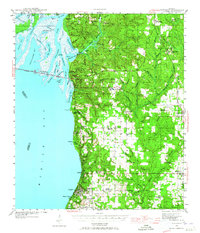
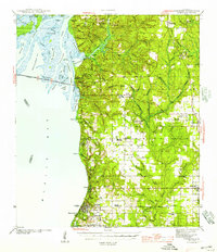
1921 Map of Fairhope
USGS Topo · Published 1921About this map
Eastern Mobile Bay defines this 1921 tactical survey, revealing the complex shoreline of Baldwin County during an era of significant coastal development. This military reconnaissance, compiled under Col. W. M. Black, shows the intricate delta system where the Tensaw River and Apalachee River meet numerous inlets like Chacaloochee Bay and D'Olives Bay. The mapping captures the early footprints of the Single Tax colony at Fairhope and the surrounding bayside communities of Daphne, Montrose, and Volanta.
Find a feature on this map
29 named features on this map. Tap any name to fly to it.
Don’t see what you’re looking for? This feature index may not catch every label — zoom into the map to look around manually.
Map Details
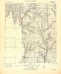
Editions of this 1921 Fairhope Map
This is the sole edition of this map. No revisions or reprints were ever made.
Historical Maps of Mobile Through Time
4 maps found