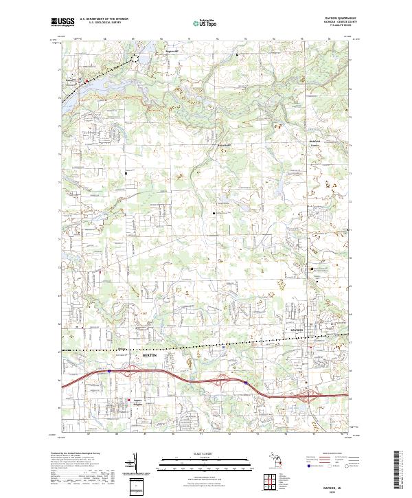
2023 Map of Davison
USGS Topo · Published 2023About this map
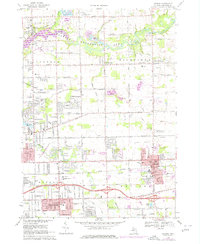
The city of Davison and the surrounding Genesee County landscape are defined by the convergence of several significant waterways and historic townships. The Flint River winds through the northern portion of the map, accompanied by the Flint River Water Trl, while numerous drains and creeks like Kearsley Creek and Black Creek network through the residential developments of Burton and Lapeer Heights. This modern survey illustrates the suburban expansion of the Flint metropolitan area, balanced by older rural clusters like Richfield Center and Rogersville.
Find a feature on this map
99 named features on this map. Tap any name to fly to it.
Don’t see what you’re looking for? This feature index may not catch every label — zoom into the map to look around manually.
Map Details
Editions of this 2023 Davison Map
This is the sole edition of this map. No revisions or reprints were ever made.