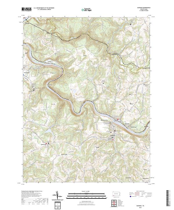
2023 Map of Dawson
USGS Topo · Published 2023About this map
Alliance Furnace stands as a significant industrial landmark near the northern boundary of this Fayette County survey, where Jacobs Creek meets the rugged terrain of Tunnel Hill. The Youghiogheny River carves a deep, winding path through the center of the landscape, dictating the placement of historic river towns like Dawson, Layton, and Adelaide. These settlements are linked by the CSX Transportation line and the Great Allegheny Passage Trl, which follows the river's course. The map reveals a dense network of family and religious heritage sites, from the Dickerson Family Cem to the Saint John the Baptist Roman Catholic Cem. High ridges like Kilndigging Hill and Fort Hill overlook a countryside shaped by both industry and faith, evidenced by numerous churches such as the East Liberty Presbyterian Church Cem serving the communities of Vanderbilt and Dickerson Run.
Find a feature on this map
112 named features on this map. Tap any name to fly to it.
Don’t see what you’re looking for? This feature index may not catch every label — zoom into the map to look around manually.
Map Details
Editions of this 2023 Dawson Map
This is the sole edition of this map. No revisions or reprints were ever made.