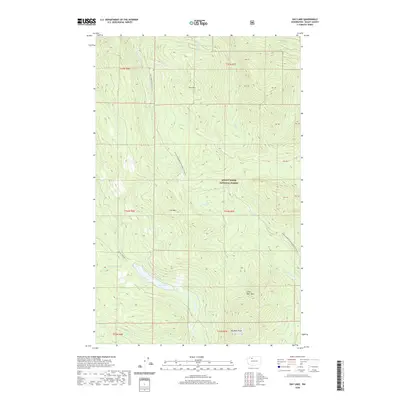
2020 Map of Day Lake
USGS Topo · Published 2020About this map
Mount Baker National Forest covers this high-elevation landscape in Skagit County, dominated by the drainage systems of Day Cr and Pilchuck Cr. The area is defined by its significant peaks, including Big Deer Peak, Little Deer Peak, and the descriptive Coal Mtn. At the heart of the terrain lies Day Lake, a central water feature fed by numerous mountain streams such as Campbell Cr and Deer Cr. Access to these remote timberlands is provided by forest service routes like Natl Forest Develop 17 Rd and the seasonal Finney Creek Rd Snowmobile 18 (Snow). The map illustrates a landscape managed for both resource extraction and recreation, with roads like Rocky Creek Rd navigating the complex topography around Iron Mtn.
Find a feature on this map
28 named features on this map. Tap any name to fly to it.
Don’t see what you’re looking for? This feature index may not catch every label — zoom into the map to look around manually.
Map Details
Editions of this 2020 Day Lake Map
This is the sole edition of this map. No revisions or reprints were ever made.
Other maps of this area

1899 · Stillaguamish
USGS Topo · 1:125,000

1901 · Stilaguamish
USGS Topo · 1:125,000

1909 · Mt Baker
USGS Topo · 1:192,000

1911 · Mount Vernon
USGS Topo · 1:125,000

1915 · Mt. Baker
USGS Topo · 1:250,000

1921 · Wickersham
USGS Topo · 1:62,500

1944 · Clear Lake
USGS Topo · 1:62,500

1951 · Wickersham
USGS Topo · 1:62,500

1952 · Hamilton
USGS Topo · 1:62,500

1955 · Concrete
USGS Topo · 1:250,000