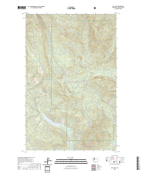
2023 Map of Day Lake
USGS Topo · Published 2023About this map
Day Lake sits at the heart of this landscape, fed by Fish Creek and giving rise to Day Creek as it flows north toward the Skagit valley. This 2023 survey of the Mount Baker National Forest captures a transition from the drainage basins of Cumberland Creek in the northwest to the high ridges of the interior. The terrain is defined by significant elevations such as Iron Mtn and Coal Mtn, reflecting the mineral-rich history implied by their names. Modern recreational and industrial access is traced via the Finney Creek Rd Snowmobile 18 Trl and Rocky Creek Rd. The map also details the complex hydrology of the region, including the headwaters of Little Deer Creek near the summits of Little Deer Peak and Big Deer Peak.
Find a feature on this map
34 named features on this map. Tap any name to fly to it.
Don’t see what you’re looking for? This feature index may not catch every label — zoom into the map to look around manually.
Map Details
Editions of this 2023 Day Lake Map
This is the sole edition of this map. No revisions or reprints were ever made.
Other maps of this area

1899 · Stillaguamish
USGS Topo · 1:125,000

1901 · Stilaguamish
USGS Topo · 1:125,000

1909 · Mt Baker
USGS Topo · 1:192,000

1911 · Mount Vernon
USGS Topo · 1:125,000

1915 · Mt. Baker
USGS Topo · 1:250,000

1921 · Wickersham
USGS Topo · 1:62,500

1944 · Clear Lake
USGS Topo · 1:62,500

1951 · Wickersham
USGS Topo · 1:62,500

1952 · Hamilton
USGS Topo · 1:62,500

1955 · Concrete
USGS Topo · 1:250,000