2022 Map of Decker
USGS Topo · Published 2022About this map
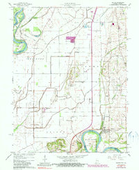
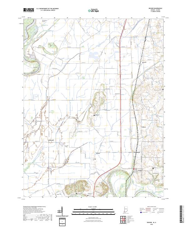
Vincennes Prairie and the winding course of the Wabash River dominate this southern Knox County landscape. The terrain is defined by a complex network of drainage systems, including Swan Pond-Ditch and Plass Ditch, which support the agricultural productivity of the lowlands. Small settlements such as Purcell, Vollmer, and Cantaloupe are dispersed along the road network, while the town of Decker sits near the confluence of the White River and the River Deshee. The map is particularly rich for genealogical research, identifying numerous family-named burial sites like Dick Cem, Bedell Cem, and Chimney Pier Hills Cem. Landforms like the Dicksburg Hills and Cane Ridge rise above the alluvial plains, offering a clear view of the area's natural topography and historic land divisions.
Find a feature on this map
105 named features on this map. Tap any name to fly to it.
Don’t see what you’re looking for? This feature index may not catch every label — zoom into the map to look around manually.
Map Details
Editions of this 2022 Decker Map
This is the sole edition of this map. No revisions or reprints were ever made.