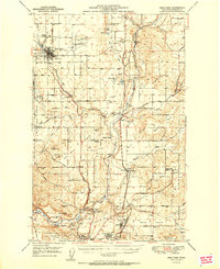
1949 Map of Deer Park
USGS Topo · Published 1960About this map
The agricultural plateaus of northern Spokane County define the landscape of this 1949 survey, notably Wild Rose Prairie, Half Moon Prairie, and Peone Prairie. These level lands supported a network of grange halls and local institutions, including the Half Moon Grange Hall and Peone-Foothills Grange. The town of Deer Park stands as the primary hub, home to the Tri-County Fairgrounds and the Woodland Cem. In the southern reaches of the quadrangle, the transition toward the city of Spokane is marked by the campus of Whitworth College and the industrial presence of an Aluminum Reduction Plant.
Find a feature on this map
71 named features on this map. Tap any name to fly to it.
Don’t see what you’re looking for? This feature index may not catch every label — zoom into the map to look around manually.
Map Details
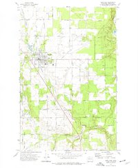
Editions of this 1949 Deer Park Map
This is the sole edition of this map. No revisions or reprints were ever made.
Historical Maps of Spokane County Through Time
4 maps found