2021 Map of Deering
USGS Topo · Published 2021About this map
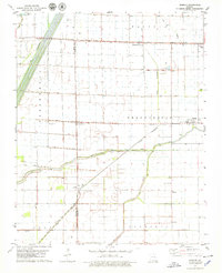
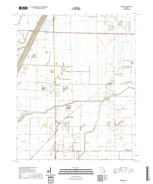
The low-lying Bootheel landscape of Dunklin Co and Pemiscot Co is defined by an extensive network of drainage channels that replaced the original wetlands of the Missouri floodplain. Settlements like Deering, Tinkerville, and Gobler are situated within a grid of county roads and state highways, reflecting a highly engineered agricultural environment. The presence of Old Channel Little River alongside more modern features like Ditch Number 74 and Elk Chute Ditch illustrates the long-term transformation of the hydrologic system. Genealogists can identify several historic burial sites scattered across this terrain, including Rising Star Cem near the eastern edge and Saint Johns Cem further south. These sites, along with the former stop at Deering Junction, provide concrete markers of the area's social history amidst its vast drainage works and cotton or soybean fields.
Find a feature on this map
54 named features on this map. Tap any name to fly to it.
Don’t see what you’re looking for? This feature index may not catch every label — zoom into the map to look around manually.
Map Details
Editions of this 2021 Deering Map
This is the sole edition of this map. No revisions or reprints were ever made.