
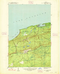
1939 Map of Delaware
USGS Topo · Published 1939About this map
The copper-rich Keweenaw Peninsula is captured here in a 1939 preliminary survey, highlighting the inland settlements of Delaware and Mandan along the corridor of U S Highway 41. These mining-era communities are shown connected by an old Railroad Grade that follows the valley of the Montreal River, reflecting the industrial legacy of the region. To the north, the shoreline of Lake Superior is deeply indented by Agate Harbor, protected by the high ridgelines of Brockway Mountain Drive. This landscape is defined by its dramatic elevation changes, from the lakefront at Grand Marais to the heights of Mt Lookout and Gratiot Bluff. Further south, the map reaches the shores of Lac La Belle, documenting the infrastructure of State Highway 26 and the County Trunk Highway network that served these remote Upper Peninsula outposts just before the mid-century.
Find a feature on this map
35 named features on this map. Tap any name to fly to it.
Don’t see what you’re looking for? This feature index may not catch every label — zoom into the map to look around manually.
Map Details
Editions of this 1939 Delaware Map
This is the sole edition of this map. No revisions or reprints were ever made.
Other maps of this area

1927 · Point Isabelle
USGS Topo · 1:31,680

1938 · Bruneau Creek
USGS Topo · 1:31,680

1938 · Delaware
USGS Topo · 1:31,680

1939 · Deer Lake
USGS Topo · 1:31,680

1940 · Deer Lake
USGS Topo · 1:31,680

1940 · Central
USGS Topo · 1:31,680

1940 · Lake Medora
USGS Topo · 1:31,680

1946 · Bruneau Creek
USGS Topo · 1:24,000

1946 · Eagle Harbor
USGS Topo · 1:24,000
1948 · Eagle Harbor
USGS Topo · 1:24,000