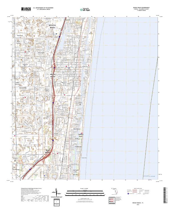
2024 Map of Delray Beach
USGS Topo · Published 2024About this map
Delray Beach and its surrounding communities are defined by the intricate engineering of the Florida coastline, where the Intracoastal Waterway runs parallel to the Atlantic Ocean. This contemporary survey illustrates the high density of modern residential developments such as Delray Shores, Tropic Isle, and Boca Harbour, often built around man-made canals and inlets like Blue Inlet. The presence of the El Rio Canal and Lake Ida Canal further highlights the region's managed hydrology, which supports both recreation and suburban expansion.
Find a feature on this map
46 named features on this map. Tap any name to fly to it.
Don’t see what you’re looking for? This feature index may not catch every label — zoom into the map to look around manually.
Map Details
Editions of this 2024 Delray Beach Map
This is the sole edition of this map. No revisions or reprints were ever made.
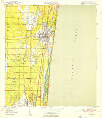
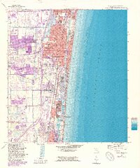
Historical Maps of Dunes Road Through Time
3 maps found