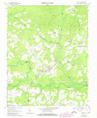
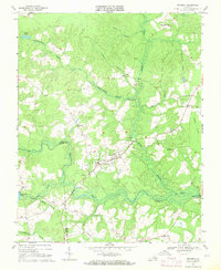
1969 Map of Dendron
USGS Topo · Published 1980About this map
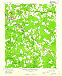
Dendron serves as the primary hub in this corner of the Tidewater region, reflecting a landscape defined by expansive wetlands and established rural infrastructure. The town features the County Academy and Jackson Sch, indicating its role as a local educational center, while nearby Spratleys Mill and a Sandpit point toward the area's agricultural and industrial roots. The terrain is dominated by an intricate network of waterways, including Johnehecohunk Swamp, Cypress Swamp, and the Blackwater River, which carve through the low-lying coastal plain.
Find a feature on this map
37 named features on this map. Tap any name to fly to it.
Don’t see what you’re looking for? This feature index may not catch every label — zoom into the map to look around manually.
Map Details
Editions of this 1969 Dendron Map
2 editions found
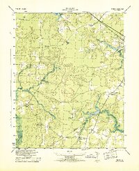
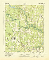
Other maps of this area

1919 · Surry
USGS Topo · 1:62,500

1919 · Disputanta
USGS Topo · 1:62,500

1919 · Homeville
USGS Topo · 1:48,000

1920 · Ivor
USGS Topo · 1:62,500

1920 · Homeville
USGS Topo · 1:62,500
1943 · Manry
USGS Topo · 1:31,680

1943 · Savedge
USGS Topo · 1:31,680

1943 · Richmond
USGS Topo · 1:250,000
1944 · Waverly
USGS Topo · 1:31,680
1944 · Ivor
USGS Topo · 1:24,000