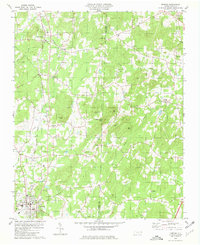
1957 Map of Denton
USGS Topo · Published 1958About this map
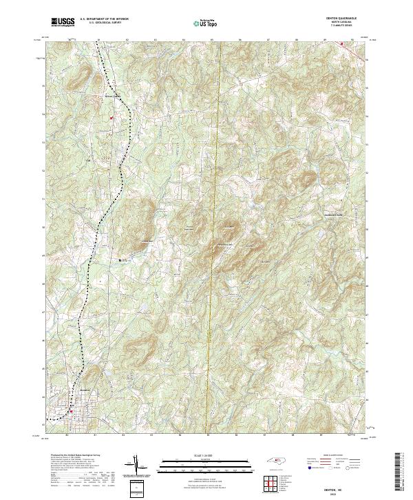
High Rock Lake and the Yadkin River dominate the western edge of this mid-century survey, defining a landscape where rural crossroads and family settlements still shaped the local geography. The industrial history of the region is evident in the northern reaches at Silver Hill, where an inactive Silver Mine sits near a network of small churches such as New Jerusalem Ch and Mercer Chapel. The terrain rises sharply toward Healing Spring Mountain and Jackson Hill, punctuated by numerous peaks like Wildcat Mtn and Three Hat Mtn.
Find a feature on this map
122 named features on this map. Tap any name to fly to it.
Don’t see what you’re looking for? This feature index may not catch every label — zoom into the map to look around manually.
Map Details
Editions of this 1957 Denton Map
This is the sole edition of this map. No revisions or reprints were ever made.
Historical Maps of Denton Through Time
7 maps found